

Clare Historic Walk
The Clare Historic Walk has been published as a fold-out itemised route with accompanying map on the reverse.
Below are images of the route and map, but the real thing is only $2 from:
-
the Clare History Room, upstairs, Clare Town Hall, open Fridays 1pm-4pm
-
The Clare and Gilbert Valleys Council Office, 4 Gleeson St, Clare, just minutes westwards from the Town Hall
-
the Clare Valley Information Centre at the reception counter.
Following these images are more details of the historic items listed on the walk.
Route of the Walk

A map of Clare's Historic Sites, each are numbered


A map of Clare's Historic Sites, each are numbered

Questions you may be able to Answer
from completing this walk:
-
What is the oldest heritage building in Clare?
-
What is the oldest heritage house in Clare?
-
Which church is closest to the Clare Cemetery?
-
Which heritage churches had their own cemetery in the early days?
-
Who built the first Clare swimming pool?
-
Are the Council Chambers at Clare Town Hall?
-
Who started the brewery in Pioneer Avenue?
-
Where is the home of Clare's first mayor?
-
When was the train line to Clare opened?
-
What is the most famous home in Clare?
Historic Places on the Walk


Historic Locations on the Walk

1. LIONS PARK 5 Victoria Rd, CLARE SA 5453
LIONS PARK is your starting point for the heritage walk.
The park was established and is maintained by the Lions Club of Clare District. An electric barbeque, shelter, toilets, children’s play equipment and lawns make it a popular amenity for residents and visitors.
BAIN ROTUNDA (State Heritage Listed #14429)
The Lions Club of Clare district took this park and improved its facilities, the Bain Rotunda, the facilities building and renovated the oval.
- Click the Green Buttons for a Google Map with Directions -

2. UNITING CHURCH 18 Victoria Rd, CLARE
(State Heritage Listed #14431), [Plaque]
The original Wesleyan Chapel, built in 1857, is now operated as Roscrow Bed And Breakfast.
The Methodist (now Uniting) Church beside it was opened in 1867, the large lecture hall & Sunday School rooms in 1888.
-
At Clare, the Wesleyans met for class meetings in a cottage as early as 1851 and by 1855 were holding services in John Maynard's house.
Read more: Top Ten Historic Buildings of Clare | Clare History
3. ST MICHAEL’S CHURCH 29 Victoria Road CLARE
(State Heritage #14500) [Plaque]


The first substantial building in the village of Clare was St Michael's Catholic Church, just the third Catholic Church in the colony of SA.
-
From 1846 to 1852 State Aid was granted to the pioneers of religion, enabled them to commence their little churches and dwellings.
-
Clare, the largest town then north of Adelaide, participated in this grant, and St. Michael's Church is built on the glebe land granted by Governor Robe and his Executive Council."
Building commenced in 1847 and was completed in 1849.
The larger, current church was completed in 1883.
Read more: Top Ten Historic Buildings of Clare | Clare History

4. RED PILLAR BOX Corner, outside 34 VIctoria Road CLARE (1886)
Of increasing rarity, this is one of two surviving cast iron pillar boxes of the Victorian era in Clare, offering a Postal collection point for the services of the Postmaster General's department (PMG).
-
The other pillar box is at 155 Main North Road, outside the old school (now Landscape SA), and is on the Local Heritage list.


5. NATIONAL TRUST MUSEUM former Casualty Hospital, former Clare Courthouse and Police Station, 4 Neagles Rock Road CLARE (State Heritage Listed #14432) [Plaque]
Built in 1850 as a police station, barracks and courthouse, it was later a casualty hospital after being altered in 1878.
-
It continued in this role until the present hospital opened in 1924.
-
This building was saved from demolition and opened as a National Trust Museum in 1970.
Read more: Clare's First Police Station | Clare Museum


6. CLARE GENERAL CEMETERY, 80 Bennys Hill Rd, Emu Flat SA 5453
[Plaque]
The Clare General Cemetery was opened by District Council of Clare in 1871. Prior to this time, Clare had been served by three church cemeteries –
-
St Barnabas Anglican on Farrell Flat Road,
-
the Presbyterian in Union Street and
-
St Michaels Catholic on Victoria Road.
Health concerns relating to the contamination of well water brought increasing pressure to the Council to make alternative provision for burials.
A forty minute return walk from the National Trust Museum, this cemetery was opened by the Council in 1872. (Initially it was supposed to be on Police Station land, but the ground was too hard to dig).
The earliest graves are the first on your left.
The gates and structure forming the winged entrance to the Clare Cemetery have been relocated from the original entrance to the Clare Oval (formerly Clare Soldiers’ War Memorial Park). These gates were manufactured locally in 1950 and until 2013 formed part of the World War II Memorial on Main North Road, Clare.


Named after the Charles Dickens’ novel, the home was built in 1872 by W.L.Beare, manager of Bungaree Station. It is still a private home.
140 Years of social entertainment and carnival evenings were held at 'Bleak House', Clare, which was also named 'Sunnyside' and 'Weroona'
Read more: Ten Houses of Clare | Clare History Group


8. ST. PAULS LUTHERAN CHURCH, 5 Sabine St , CLARE (Large Sign)
The first Clare Lutheran church was the brickwork Clare Bethlehem Lutheran Church, with the church on Burton and Strickland Streets and the manse located at 53 Gleeson Street, belonging to the ELCA division.
-
UELCA Lutherans worshipped either at the Clare Institute or at the nearby historic Blyth Lutheran Church.
-
A Clare building committee for UELCA was formed in 1948 and plans for the church were prepared by August of that year.
-
The first sod was turned on 31 May 1951 with the Foundation stone being laid on 25 November 1951 by Pastor H Stiller. However it was another two years before the church was completed and dedicated.
-
In 1967, the two branches amalgamated nation-wide and so the congregation of Clare Bethlehem Lutheran Church also amalgamated with the Immanuel Lutheran Church at Sabine Street, after which it was renamed St Paul’s.
(A car wash now occupies their former Strickland/Burton Street site).
The congregation grew and so a hall, Sunday School rooms, kitchen and conveniences were added to St. Paul's building.


9. KNAPPSTEIN WINERY, 2 Pioneer Avenue, CLARE [Plaque]
(former Clare Brewery & Chimney) (State Heritage Listed #14428)
This distinctive building began life in August 1878 as Clare Enterprise
Brewery, making Racecourse Beer as well as lemonade and soda water.
Major extensions and new equipment came in 1913, but beer brewing
ceased here in 1916 following changes to the liquor laws.
-
In 1917 aerated water and cordial production was continued under the name of Clare Mineral Waters Company.
-
In 1976 it became the home of Knappstein Wines. Brewing of beer recommenced in 2007.


10. MAYNARD PARK formerly Pioneer Park, 26 Farrell Flat Rd, CLARE (Local Heritage Listed #14502)
This area was originally called The Twins after two large twin gums on the site.
Blacksmith John Maynard used a seat cut in a large gum tree to serve meals to shearers in the 1840’s, and it is this tree, in the park, which is on the Local Heritage list.
-
The tree and park were presented to Clare Corporation in 1941 by Mrs. Diana Christison.
Read more: Generous Mrs. Christison | Clare Museum

11. GLEESON WETLANDS, INCHIQUIN LAKE AND MELROSE PARK Enter via Christison Ave, Phoenix Ave, or White Hutt Road CLARE
Gleeson Wetlands is fast becoming popular among walkers, cyclists, bird watchers and native plant enthusiasts.
-
An easy 20-minute walk along relatively flat paths will take you around the wetlands where picnic shelters, as well as a bird hide, make for a pleasant outing.
-
The huge variety of native plants provide habitat for a multitude of birds including white-faced herons and rainbow lorikeets.

12. ST BARNABAS CHURCH 25 Farrell Flat Rd, Clare
(State Heritage Listed #14417) [Plaque)
St Barnabas’ Church of England was built in 1851, and restored in 1857.
-
A cemetery in the churchyard has graves dating back to the 1850’s. Of particular interest is the family crypt of E.B. Gleeson, first Mayor of Clare.
Built from 1851, in simple Gothic Revival design, St Barnabas was the outcome of much active lobbying by the founder of Clare, E.B. Gleeson, and other local people of influence.
-
It is claimed to be the oldest Anglican church north of Adelaide.
-
It is one of the earliest surviving rural Anglican churches of its type and reflects the religious aspirations of settlers at the time.

13. BILLYGOAT HILL LOOKOUT 23 Wright St, CLARE
The lookout received its name after a journalist from Adelaide was misled into believing that ‘Billygoat Hill’ was its correct name.
It has an excellent view of Clare township and surrounds from this vantage point, which is reached either by a steep and difficult climb from Wright Place, or a drive on Union Street along the hill from Mill Street.
It looks out from the top of Clare's first quarry.

14. HOPE COTTAGE 11 Wright Street CLARE
(State Heritage Listed #14433)
Built circa 1850’s & one of the earliest surviving dwellings in Clare. It was home to the McKinnons, then the Baxter family from 1923 until recently and their eight children were raised there.
The original wooden shingles are beneath the iron on the roof.


15. Former PRESBYTERIAN CHURCH Site, 27-31 Union Street CLARE
The foundation stone was laid on 23 Apr 1856 by Rev J S Moir. Built of bluestone, and opened 3 Aug 1857 as the Free Presbyterian Church on land given by William Gordon McKay.
The manse was built in 1866. It closed in 1998 when most Presbyterian, Congregational & Methodist congregations combined to form the Uniting church, and was demolished in 1983 due to vandalism.
Read more: A Book available from the Clare History Room:
CLARE PRESBYTERIAN CHURCH - a history 1856-1988
by Helen Dickeson (1993). 120pp $14

16. Former Mill Street School, 19 Mill Street CLARE (Local Heritage Listed #14496)
Built in 1872, Clare’s first public school cost £605/16/5, £200 of which came from a government grant.
-
It was reported that the opening of the School reduced the number of children roaming the streets and making mischief.
-
The Salvation Army used this as their first meeting place in the 1880's.
The building is now a private residence.
Read more: Rosa Hawker – School Mistress at Clare | Clare Museum

17. MILL STREET COTTAGE 2 Mill Street CLARE
(State Heritage Listed #14425) [Plaque]
This six-roomed two-storey building was erected for Mr. Richards, a wheelwright, in 1872, using locally quarried limestone from the nearby quarry, (now the car park behind Woolworths).
-
This cottage now houses commercial offices.
-
Local sandstone was used for the 18in thick ground floor walls and 12in for the upper floor. Mintaro slate flags were used to floor the verandah and kitchen.
-
The masonry was by Rogers and the joinery by James Richards, first owner, a blacksmith and wheelwright.
Read more: Top Ten Heritage Houses of Clare | Clare History


18. CLARE PUBLIC LIBRARY 33 Old North Rd CLARE
(State Heritage Listed #14427) [Plaque]
A fine example of Italia/late architecture, the former lnstittute building was constructed in 1872 and now houses the Clare Public Library.
-
Local philanthropist Dr J.W.D. Bain was instrumental in its construction and operation.
Read more: Daring Dr Bain of Clare | Clare Museum


19. CLARE COURTHOUSE 34 Old North Road CLARE
(State Heritage Listed #14495) [Plaque]
The courthouse was built next to the Clare Institute, occupied in 1880, and is still used today. It replaced the Old Courthouse, now the Clare Museum.
-
In the 1920's a new police sergeant's house and cells were built next door.
-
A modern purpose-built police station on Main North Road opened in 1979.


20. FORMER CHAFF MILL, Ragu Restaurant 308 Main Street CLARE
(Plaque)
Erected in about 1860, the Chaff Mill was originally part of E.B. Gleeson’s property, Inchiquin, the mayoral estate now 1 km up the road.
-
This restored chaff mill is the oldest commercial building still standing in the Main Street of Clare.
-
The original loft and well, which supplied water to nearby homes, are now features of the building, which was saved from demolition in 1987, and now houses an Italian restaurant.


21. TAMINGA HOTEL 302 Main North Road CLARE
Formerly Clare Inn, and the Commercial Hotel. This was the second hotel opened in Clare.
-
Known in 1849 as the Clare Inn, with the first licensee, policeman Dennis Kenny, who had held a storekeeper’s liquor licence from 1847. A coach service to Gawler was staged from here with stables and on large acreage.
-
New owners named it the Commercial Hotel, and it was demolished and in 1876 a larger and realigned single-story hotel was built. It kept its license after 6 o'clock closing was introduced, whereas the Ford, Globe and Stanley hotels closed down.
-
A second story was added in 1921 with eleven bedrooms, two bathrooms and a drawing room. A new wing of twelve bedrooms was added in 1927.
-
The current name of this hotel, Taminga, is an aboriginal word meaning white gum and was named in 1958 for the Australian Taminga wine grape variety developed by CSIRO as a suitable grape for the warmer Australian conditions, named for the Knappstein's Taminga vineyard in the Clare Valley.

22. Former Globe Hotel 275 Main North Road, CLARE (Plaque)
From 1859 a shop owned by Julius Victorsen stood on this site. The contractors for this ‘very handsome edifice’ were Duncan and Barnley.
-
When land for farming opened up north of Clare the numbers of travellers seeking accommodation in Clare increased markedly.
-
Astute businessman Daniel O’Leary, who owned the first flour mill in Clare, leased the building in 1869 for twelve years, intending to refurbish and operate it as a hotel.
-
This done, he successfully applied for a licence in 1870, becoming the first publican of the fifth hotel in the main street.
-
The Globe closed in 1919 following the introduction of 6 o'clock closing in 1915.


23. Former Billiard Saloon, now the RSL Community Hall,
94 Burton Street, CLARE (Plaque)
The original structure was erected in about 1877 by the publican of the adjacent Ford’s Hotel, William Edward Ford, as a billiard room.
-
In August 1877, seventy people watched as ‘noted knights of the cue’, Messrs. White and Albers, gave a demonstration of their billiard skills.
-
William Ford left Clare in 1878 and after his death in 1898, the billiard room was purchased by Miss Anne French who used it as a dress-making establishment.
The R.S.L. continues to use the building, but in 1992 it became a Day-care Centre and community meeting rooms under the outreach program of the Clare Hospital.

24. Former Shamrock & Thistle Hotel, Ford's Hotel 266 Main North Road CLARE (Plaque)
The original Shamrock and Thistle Hotel was opened in 1854 and featured two adjoining premises, one serving as a hotel and accommodation. The other was the largest entertainment room in Clare, where many meetings were held.
-
In 1859, the first ‘telegraph instrument’ was installed in the hotel, thus linking the town with the rest of Australia.
-
William Edward Ford became the licensee in 1871 and changed the name to Ford’s Hotel. He upgraded the hotel to include a bathroom and a billiard room.
-
After being licensed to 26 different publicans, Ford’s Hotel was closed by the Licensing Board in 1920. It was demolished in 1981 to make way for Edwards’ arcade.
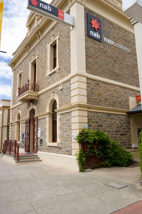


25. NATIONAL BANK 254 Main North Road CLARE
(Local Heritage Listed #14497) (Plaque)
-
Fri 3 Dec 1880: "The National Bank, too, are having a building erected. In the course of a brief period, if such like edifices are 'run up' Main-street will be something to admire. The banks must be paying institutions when they cause to have built such colossal places."
-
Sat 1 Jan 1881: "The new National Bank is already assuming an imposing appearance, and Mr. Munro, the contractor, is to be congratulated on the progress he has made."
26. CLARE HOTEL 244 Main North Road, CLARE (Plaque)
"The Clare Hotel, (is) a building not to be surpassed in any portion of the province."
-
This impressive two-story hotel was built in 1871 to the design of architect Robert Rickham Page.
-
Music was a feature of these premises, provided by a sensational twelve-barrel organ. Large crowds gathered to listen.
-
Brass band concerts were also staged on festive occasions, from the full-width balcony over-looking the main street.
-
Now known as the 'Middle Pub', this is the only hotel in Clare to keep the same name throughout is history.


27. Former Northern Argus Office 245 Main North Road, CLARE (Plaque)
Founded by brother-in-law Henry Tilbrook and Alfred Clode, the business was first operated from a small building on what is now Victoria Road.
-
The paper’s operation moved to a new building on this site on 6th October 1871. (Hence Cafe 1871)
-
The paper stayed in the Tilbrook family until it was purchased by Rural Press in 1996 after which printing moved elsewhere.
-
The Northern Argus moved from this location to purpose-built premises in 2005.


28. ANZ Bank, (former ES & A Clare Branch) 243 Main North Rd, CLARE (State Heritage Listed #14422) (Plaque)
This fine building was erected in 1877, at a cost of £4,000, on behalf of the English, Scottish and Australian Chartered Bank.
-
This elaborate two-storey banking chamber and offices is one of the finest examples of a late nineteenth century banking house in the Lower North.
-
It contains many classical influences in its design and is an example of fine masonry work. The bank adjoins the original Northern Argus office to the north. In 1985 the building was refurbished in keeping with its historic character.
-
The stables to the east were converted to a function area and later a commercial outlet.
%20Main%20St%20Clare.png)
29. ENNIS PARK, former CLARE FLOUR MILLS 1854 – 1924 (Plaque)
(next to the ANZ Bank)
This site of about one acre of land was purchased in 1848 by the Roman Catholic Church for £130. It was given to publican Daniel O’Leary of Sod Hut Inn on the condition that he erect a flour mill.
-
In 1854, Mr EB Gleeson laid the foundation stone under which O'Leary placed a mysterious relic to keep the mill from harm.
-
The three-storey building had a sixty foot chimney stack and featured three pairs of mill stones. It started production in 1855 milling local wheat.
-
By 1867 the mill was very busy, and with 50,000 bushels of wheat stored there, larger premises were needed.
-
A new two-storey mill was built abutting the first one. Using equipment imported from USA, the mill produced Kimber’s Snowdrift Roller Flour at five to six bags an hour.
Read more: A Clare disaster: Fire at the Flour Mill | Clare Museum


30. CLARE TOWN HALL, 229 Main Street CLARE
Built in 1925-1926 in a simplified classical style, by Mayor builder Mr. A. J. Bowley for £6,990.
-
The South Australia Governor, Sir Tom Bridges, accompanied by Lady Bridges, opened the new Town Hall on April 21, 1926.
-
After the opening ceremony. Sir Tom and Lady Bridges received the townspeople.
-
Earlier in the day Sir Tom visited the schools and the local hospital, and at one o'clock attended a luncheon at the old Town Hail.
The new hall has an attractive appearance, and a Corinthian archway and pillars at the front give a finishing touch.
-
Four offices are on the front of the ground floor of the building.

31. Former TRAVELLER'S REST HOTEL, former STANLEY HOTEL
232 Main North Road CLARE (Plaque)
This was the site of the first hotel licence in Clare, granted in 1846 to John Ryan, who was both publican and postmaster at the Traveller’s Rest Hotel. It was re-named the Stanley Hotel in 1879.
The site of the former Stanley Hotel is the building which formerly housed Clewers Carpets.
-
This was the site of the first Presbyterian wedding ceremony in the town.
-
A near tragedy occurred in 1870 when a Russian guest at the hotel, Joseph Anthonieff, severely hacked his room-mate, John Luckhurst Smith with a tomahawk. Smith survived and became Clare Town Clerk.
-
It lost its license in 1920, as one of three too many hotels in Clare, when not upgraded in time, and was demolished in 1923.


32. Former OLD TOWN HALL 203 Main North Road CLARE
(Local Heritage Listed #14423) (Plaque)
Distinguished by the blank clock apertures in the tower, the building was erected in 1866 by a private company and sold to the Clare Corporation in 1875.
-
The District Council of Clare was formed in 1853, the first council in the North of the state.
-
Most of the township became the Corporation of Clare in 1868, with Mr. E.B. "Paddy " Gleeson as Mayor.


33. BENTLEY'S HOTEL, former NORTHERN HOTEL 191 Main North Road CLARE (Plaque)
This imposing building dominates the entry to Main Street from the south.
-
This hotel was built by Mr Jack Spratt in 1861.
-
It was ‘a two-story edifice, four rooms above, four rooms below with a bar room attached'.
-
It became a well-known rendezvous for bullockies and teamsters.
-
The first licensee was Mr Henry Catt, followed in 1869 by owner and licensee, Henry Robert Bentley. The Bentley family then ran the hotel for 69 years, during which time they made many additions to the premises.
-
The second storey was extended in 1874.
34. FORMER SAVINGS BANK OF SA 190 Main North Road CLARE (Plaque)
In 1930 these premises were built as a ground-floor banking chamber for the Savings Bank of South Australia and to house, on the top floor, its then manager Mr.J.F. McGrath.
-
Designed by Mr. W.H.Harral of Adelaide, it was built by Clare builder Mr.A.J.Bowley who was also the Mayor of Clare at that time.
-
The banking-chamber counter and fittings were the work of Mr.W.Durward.
-
At the invitation of the Chairman of the Savings Bank, Sir Herbert Phillips, Mr. Bowley opened the bank on 26th. Of September 1930.


35. FORMER AMP SOCIETY BUILDING, former ETSA BUILDING
187-189 Main North Road CLARE (Plaque)
This site was first used as stables for a coaching company. The building was constructed for the Australian Mutual Provident Society in 1917 at a cost of £5,000 and originally included a five-bedroom residence.
-
It also housed the first offices of the Savings Bank of South Australia.
With its ornately carved stone frontage, it forms an impressive entrance to the town’s main commercial area. The AMP Society used it until 1950.
-
It then served as the administration centre for the Electricity Trust of South Australia (ETSA) and was locally known as ‘the castle’.
-
It housed the head office for six ETSA districts with 130 employees. The property passed into private ownership in 2005.

36. Former SALVATION ARMY CITADEL 187 Main North Road, CLARE
(Plaque)
The Salvation Army came into the Mid-North in 1884, commencing service at the old Public School, and had very controversial beginnings. Their officers and building suffered considerable harassment from the local population, and they left the district.
-
They returned to Clare in 1922 and built the citadel in 1926, opened on October 9th, with the Mayor in attendance.
-
The building was sold privately in 1996.
-
It has since served as a restaurant, hair salon, and doctor's surgery.


37. MID NORTH ELECTRICAL SUPPLY COY. 9 Lennon St CLARE (Plaque)
In 1924, an electricity supply was assured through the formation of the Mid-North Electricity Company.
-
A three phase alternating current which could be transmitted over high tension lines to other country towns was proposed for Clare.
-
A sole right to supply electricity to Clare, Auburn, Saddleworth and Riverton, for a period of twenty years commencing on 1 July 1925, was negotiated with Clare Corporation and nearby District Councils.
-
Walter Whitney was appointed engineer in charge of this scheme, and this powerhouse was built in Lennon Street dated 1925.
1 July 1925 was an epoch making day for Clare and district for it was then that electric light was first switched on and a task which was regarded by many local residents as impossible, was accomplished.


38. Former CLAREVALE WINERY 15 Lennon Street CLARE
The Clarevale Cooperative was Clare's second winery, founded in 1930, with a loan of 8,000 pounds from the State Government, but started crushing wine in 1929 as Clarevale Growers' Winery.
-
The cooperative is famous for producing the first Clare resident to graduate as a winemaker – Jim Barry in 1947 (pictured left).
-
Bill Taylor (now Taylor's Wines) was a Hotelier in Sydney who bought wine from the Clarevale Co-operative, and developed a relationship with Jim Barry, who left Clarevale in 1969.
-
Taylor's moved to the Clare Valley to make their own wine. Clarevale Winery foundered.
-
-
Control of Clarevale passed to Kaiser Stuhl (for champagne), then to Penfolds, and was finally liquidated.
Read more at The Story of Clare's Wineries | Clare Museum:
Chapter 2: The Boom in Clare Wine Making
Chapter 3: Clare Wines between the Wars
Chapter 4. Clare Wineries in the post-War Boom


39. The RIESLING TRAIL HEAD, top of Lennon Street, CLARE
The 1983 bushfires that destroyed sections of the Riverton to Spalding train line,
-
the decision to shut the line down, and
-
the demolition and removal of the rail infrastructure
could have devastated a lesser community than that of Clare.
Instead it opened the way for a trail to be created that would enhance tourism of the Clare region and make good use of the derelict and unsightly rail corridor.
The tops of Lennon and of Dominic Streets used to lead to the Clare Railway Station, now remembered as a railway platform, and an engine memory.
-
The Station itself was first built on the hilly side of the line ( ! ) and was later moved to the township side for the safety of passengers and freight.
-
The old Stationmaster's House still grandly exists at the corner of Lennon and East Streets. Now a private home, it has an excellent garden, and housed a now famous author, Monica McInerney, now memorialised by the Trail.
Read more: Clare's most famous House? | Clare Museum


40. Former STANLEY LEASINGHAM WINERY, now Mr Mick Winery Cellar Door and Kitchen, 7 Dominic Street CLARE
(State Heritage Listed #14416)
The Clare wine industry was given its greatest boost in the early 1890s when Mr John Christison, one of the larger Clare Valley wine growers, and a beer brewer in Clare, could see the need to process the Clare grape harvest locally, and as a consequence he approached Joseph Knappstein who helped him establish the Stanley Winery.
-
In 1902 Joseph sold his business in Western Australia and returned to Clare to take charge of the Stanley Wine Company, due to a crisis in the export side of the business.
-
By 1903 Stanley were producing over 378,000 litres of wine from most of the annual grape harvest in the Clare Valley.
Mr Knappstein was successful in finding markets in the United Kingdom and on the Continent of Europe, and since that time the company has never looked back. It changed ownership after Joseph Knappstein's death.
-
Knappstein's new owners moved the winery to Pioneer Avenue, and closed down this winery.
-
Then Tim Adams (pictured left) invested in it as 'Mr. Mick', named for legendary winemaker Mick Knappstein, one of Joseph's sons, and mentor to Tim Adams.
-
Keeping 'Tim Adams' as a prestige label, Mr Mick sells more affordable wines.

41. SOLDIERS MEMORIAL GATES 178 Main North Road, CLARE
(State Heritage Listed #14420)
This work was planned and organised by the Clare, Hutt, and Hill River Soldiers' Memorial Fund Committee, whose great success is due largely to the work of Mr. L. A. Davies (Chairman) and Mr. A. J. Bowley (Hon. Secretary).
-
The structure, which has been erected at the entrance to the Clare Oval in 1922, may best be described as a triumphal arch. It more than spans the old entrance to the recreation ground.
-
On the artistic stone columns on either side there are tablets on which are engraved the forty-one names of the fallen, and at the summit there appears a trophy of the helmet and arms suggesting the military nature of the monument.


42. BAPTIST CHURCH 173 Main North Road, CLARE (Sign)
The Reverend George Hogben opened the Clare Baptist Church on 1st March 1891.
The consecration of the church was the culmination of four years of hard work by the small but enthusiastic congregation.
-
They had overcome controversy and opposition to worship as members of the Baptist Church.
-
The first service, held in 1887, was attended by about 500 supporters and onlookers. It was held at the Clare Swimming Baths and included the baptism by immersion of nine adults who thus became members of the church.


43. Former PRIMARY SCHOOL 155 Main North Road, CLARE
(State Heritage Listed #14424)
The first public town school was opened in Union and Mill streets in 1869.
It was later replaced by this state government school on the Main Road in 1879. This primary school was added to in 1885 and again in 1909.
When a brand new modern Clare High School opened in 1971 in the north of the town this primary school campus became the TAFE campus. The primary school then moved into the former Clare High School campus which was built in 1925.


44. Former HIGH SCHOOL 137 Main N Rd, CLARE
-
Housing the Clare Primary School since 1971.
Agitation for a high school commenced in 1918 by the primary school committee.
-
Various Education officers had expressed approval of the project, but it was not until 1921 that it was decided to open a High School in Clare, owing to the efforts of Sir Henry Barwell and Mr. (Robert Dove) Nicholls.
-
Mr E J Flaherty, B.A., had been appointed in charge.
-
During the five years of its existence the school had progressed and now had an attendance of 65 scholars. Mr Flaherty bad carried out his duties very successfully.


45. ARMY DRILL HALL 50 Beare Street CLARE
(Australian Heritage Register #101383)
The site for the drill hall at Clare was acquired on 4 July 1914. A corrugated galvanised iron Type 4 Drill Hall with five orderly rooms was built at a cost of 666 pounds fifteeen shillings and 10 pence.
-
The building was completed on 23 June 1915 with the wooden floor, gates and lighting completed on 31 December 1915.
-
A rifle range was completed in October 1921 to the west of the drill hall.
-
Extensions were added to the drill hall in 1937 and 1942 and the parade ground sealed in August 1969.


46. BAIN ROTUNDA, Bridge and Palms, behind Clare Oval
Main North Road, CLARE (Australian Heritage Register #10622)
The Rotunda is significant because it reflects the social history of Clare in its representation of the township's tribute to one of its leading citizens and benefactors between 1865-1890s.
-
Dr John Bain, who settled in Clare in 1865, donated land for the local institute and provided a swimming pool/skating rink for the local people's use.
-
Architecturally, the Rotunda is a delightful public amenity and a significant example of a building type which exhibited the style and civic awareness of the time.
-
Environmentally, the Rotunda is a significant visual element in the traditional character of Clare and particularly around the sports ground.
-
Avenue of Oak Trees Lennon St, Clare, SA, (Register of the National Estate)
-
Broughton River Rail Bridge Spalding - Rivertown Railway, Spalding, SA, (Register of the National Estate)
-
Bungaree Homestead Complex Main North Rd., Clare, SA, Australia (Indicative Place)
-
Clare Urban Conservation Area Clare, SA, Australia (Register of the National Estate)
-
Hill River Main House, Coach House & Stables Farrell Flat Rd., Clare, SA, (Register of the National Estate)
-
Hill River Managers Cottage and Station Village Complex Farrell Flat Rd., Clare, SA, (Indicative Place)
-
House 9 Old North Rd., Clare, SA, (Register of the National Estate)
-
Inchiquin Homestead Main North Rd., Clare, SA, (Register of the National Estate)
-
Kookynie Homestead, Clare, SA, (Indicative Place)
-
Miners Home Hotel & Outbuilding (former) Blyth Rd., Armagh via Clare, SA, (Indicative Place)
-
Post Box VR - opposite 155 Main North Rd., Clare, SA, (Register of the National Estate)
-
Primary School Residence 137 Main North Rd., Clare, SA, Australia (Register of the National Estate)
-
Sevenhill Winery (off) Main North Rd., Sevenhill via Clare, SA, (Indicative Place)
-
Spalding Native Grassland Site No 2 Frome Crossing Rd., Frome Crossing via Spalding, SA, (Indicative Place)
-
Spring Gully Conservation Park, Spring Gully via Clare, SA, (Register of the National Estate)
-
St Michaels Anglican Church Main North Rd., Bungaree via Clare, SA, (Register of the National Estate)
-
St Stanislaus Catholic Church (former) Government Rd., via Mintaro, SA, Australia (Register of the National Estate)
-
Windsor Lodge 33 Union St. Clare, SA, (Register of the National Estate)
-
Wolta Wolta West Tce., Clare, SA, (Register of the National Estate)